Staying a Step Ahead of Mother Nature
By Jennah Denney
Mother Nature tends to have a mind of her own. Utility power lines are vulnerable to damage from severe storms—particularly fallen trees and limbs, which can lead to power outages. About 50% of outages are caused by overgrown vegetation, which is why electric utilities regularly trim and maintain their local systems.
This starts with significant on-the-ground labor, including manual data collection, as workers assess the vegetation that needs to be cleared while walking below the infrastructure. Following the trim work, manual verification of its quality and completion is required.
This has been the standard approach for the past few decades. But as extreme weather events increase and digital tools improve, electric utilities are looking to innovative vegetation management methods to improve power reliability for consumers.
With the help of technology, utilities may be able to dispatch trimming crews at the ideal moment and location, preventing additional outages while enhancing productivity, cutting costs and providing better service.
Timely monitoring can help identify infrastructure susceptible to damage. Finding the right technology makes this process more efficient.
Each vegetation management tool has advantages.
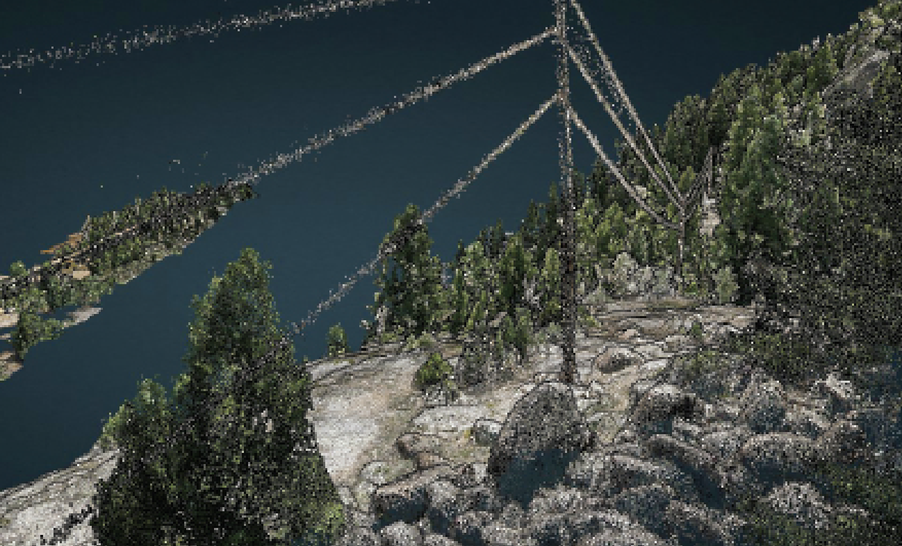
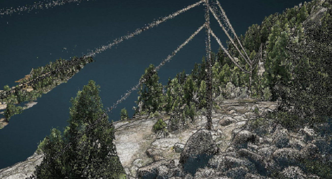
Lidar—which stands for light detection and ranging—gives exact, 3D data about the shape of the surface around utility assets. Lidar is a popular way to scan portions of forests to determine the height of trees. The technology doesn’t generally assess plant health but can pair with high-resolution multispectral satellite imagery to help define areas of need.
Satellites provide coverage 24 hours a day and can supply two kinds of images: a wide view of the area near utility assets and a more detailed micro view. Satellite data can often be used in place of other monitoring methods.
With satellite technology, utilities can learn a lot about local vegetation, including:
Health. Information gathered makes it possible to predict vegetation growth based on real conditions.
Dryness. This information is valuable for determining the likelihood of a wildfire and how to protect utility infrastructure.
Satellites are always in orbit around the Earth, so data can be updated quickly, in real time. This makes it possible to respond swiftly and precisely.
Today, satellite images can have a spatial resolution to within 1.6 feet, making it easy to spot when vegetation grows in the rights-of-way near power lines and utility equipment.
Typically, satellites speed up the process of inspecting power lines because they provide information for making data-driven decisions about vegetation management.
Electric utilities can also use fixed-wing aircraft and drones to monitor and control the growth of trees and plants near power lines. Drones fly close to equipment, take clear images and provide data to help show how close vegetation is to equipment and check the health of trees.
Many utilities use drones with cameras.
When it comes to taking care of surrounding vegetation, drones are often used for detailed surveys rather than large-scale monitoring like satellites.
Once lidar or satellites—often together—have collected data on a large amount of vegetation near power lines, drones can be used to inspect a single area and do all the necessary checks.
Public power utilities place a high focus on vegetation management. It is the most crucial tool for reducing the likelihood of power outages. A thorough understanding of the vegetation’s past, present and projected future is essential for a successful approach to reducing these risks.
The growth of lidar, drone and satellite data presents an opportunity to close the loop with continual data-driven vegetation management intelligence and increase the power line system’s dependability and safety. In the end, all three technologies for managing vegetation serve different purposes, and electric utilities choose the options that work best for them.